While our Hän-speaking ancestors were known as “People of the River”, our traditional territory also included the high mountain country to the north and south of the Yukon River valley. In the vast area that now includes Tombstone Territorial Park, we had close ties with the Gwich’in and we both relied on two annual migrations of the Porcupine Caribou Herd to supply us with food, clothing and much else.
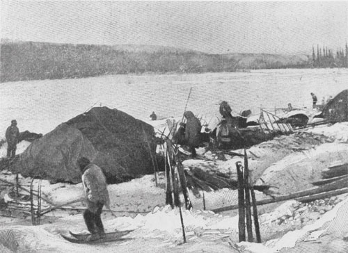
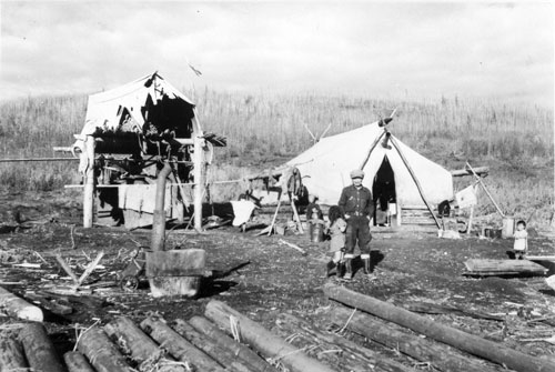
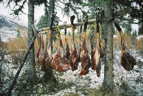
After the Klondike Gold Rush, hunters sold tonnes of caribou meat in Dawson City. They then returned to the Blackstone country to trap for fox, wolf, and wolverine. Black City, also called Blackstone City, was one of the camps used as bases for hunting, trapping, and travelling on the land by the Tr’ondëk Hwëch’in, Tukudh Gwich’in and Tetl’it Gwich’in.

Location & Landscape
Location
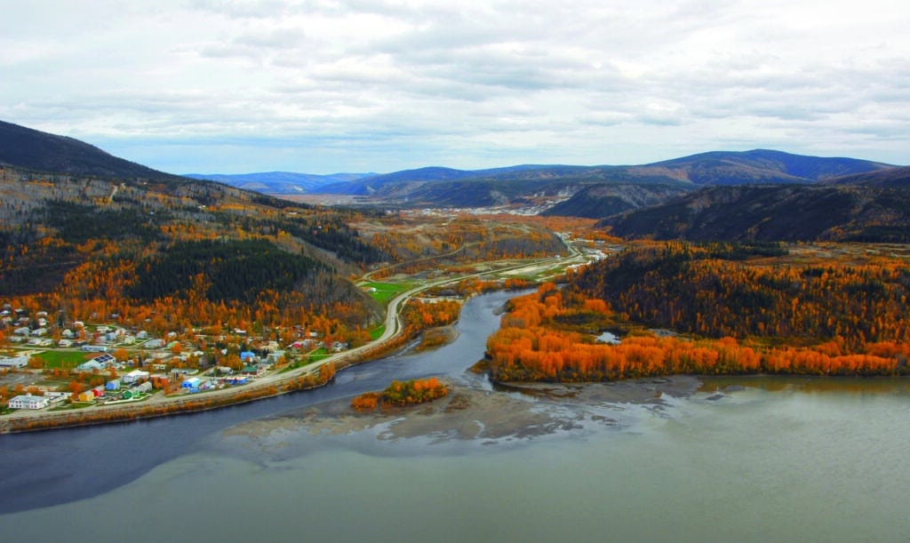
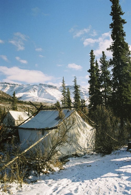
The site of Black City lies in the north end of the Tombstone Territorial Park on the banks of the Blackstone River. Legally, it is part of Tr’ondëk Hwëch’in Settlement Land parcel S-145B. There are no physical remains of the former camp. We ask that you treat this area as private property and refrain from visiting the site but we do welcome you to enjoy the natural heritage of the Blackstone Uplands.
Landscape
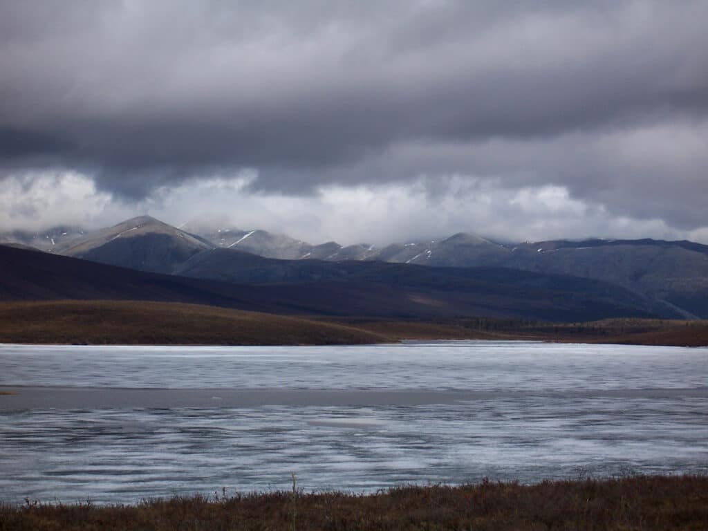
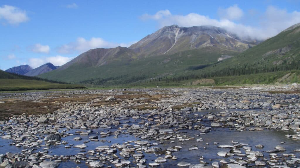
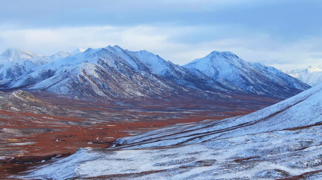
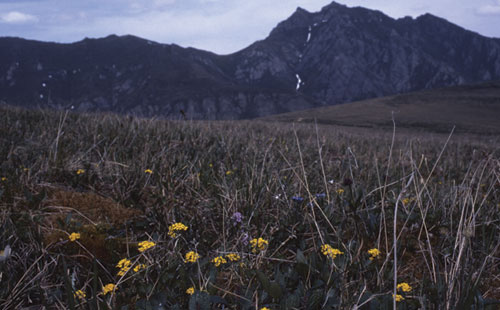
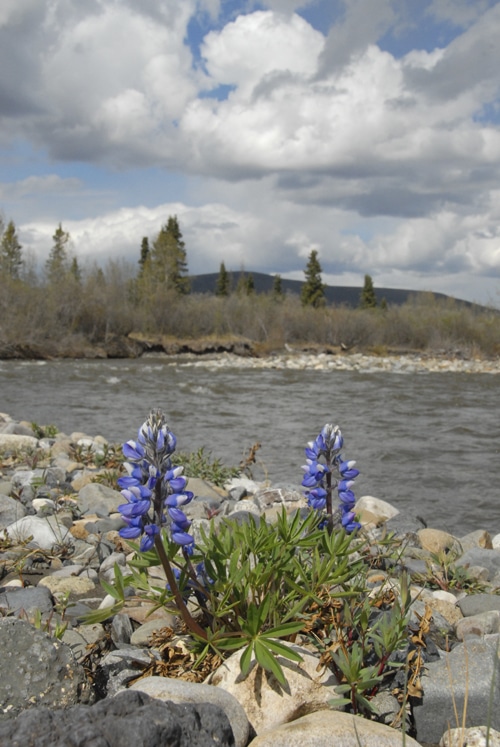
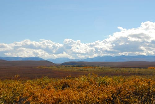
The country of the Blackstone Uplands is a dramatic landscape of distant mountains, river and creek valleys, and rolling tundra near the edge of the treeline. The high plateau is connected to the Yukon River valley through Seela Pass and down the drainage of the Chandindu or Twelvemile River. To the south are the mountain ranges of Tombstone Territorial Park and the valley of the North Klondike River.
Beringia
During the last ice age, when most of North America lay buried under glaciers, this area was part of Beringia and covered by a vast grassland called a mammoth steppe. The ice-free zone included parts of Siberia, the Bering Isthmus, Alaska, Yukon and the Northwest Territories.
Beringia formed a land bridge between North America and Siberia. Animals, plants and insects moved back and forth across the bridge. The land was populated with woolly mammoths, steppe bison, saiga antelope, camels, scimitar cats, giant short-faced bear and beavers the size of black bears. Although many of these ice age animals did not outlast the cold climate, their remains are still found in the frozen earth by scientists, placer miners and others. Some of the animals that did survive the ice-age include caribou, moose, Dall sheep, and grizzly bears. Even today there are the rare creatures and plants that exist nowhere else but in the former area of Beringia. There is archaeological evidence showing that people lived here from the end of the last ice age, some ten thousand years ago. Much like our ancestors, these mammoth hunters worked hides, gathered edible plants and engaged in other subsistence activities.
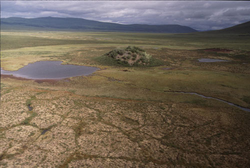
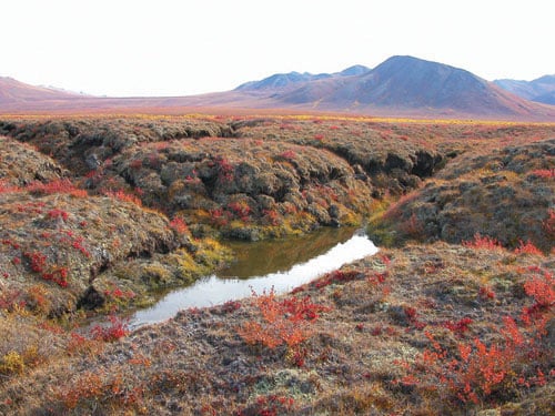
Permafrost
Even in summer, when the tundra is green and flowering, ice is never far from the surface. Permafrost is permanently frozen soil that remains below 0°C throughout the year. This frozen ground is discontinuous in the Blackstone Uplands, but it has some dramatic permafrost features.
Some permafrost features that can be seen in the Black City area include:
- Pingoes – a pingo is a conical hill or mound with a core of ice. Pingos are formed through the pressure of the water freezing in a contained space, causing the ground to expand upwards. Pingoes can be very large (up to 65 metres high) and persist for many years. The name ‘pingo’ is an Inuit word.
- Patterned Ground / Polygons – this is where the topography appears sorted into regular patterns of varying size and often geometrical shape, usually observed as differing elevation, soil composition and vegetation.
- Frost Mounds / Palsas – peaty, ice-cored mounds a few metres high. These are usually found in areas of discontinuous permafrost and form and melt each year.
Archaeology
I really appreciate what they're doing now; they work together, non-status and status, and the non-Indian people. It's really good and they know what the country feel like. You just come in here, you gonna feel it. Nobody rush here, time don't mean anything.
PERCY HENRY, 2002, about the archaeology work at Black City.
This bounteous land was also home to ancient hunters. Archaeological evidence shows continuous use of this area for at least 10,000 years when this land was still part of Beringia, the steppe tundra that remained ice-free during the most recent glaciations.
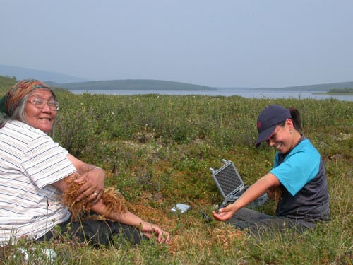
Since 1989, archaeologists have worked with elders and Tr’ondëk Hwëch’in citizens on a number of archaeological surveys along the Dempster Corridor and within the area of present-day Tombstone Territorial Park. They have identified numerous sites where tool makers crafted points from chert, a fine-grained sedimentary stone. At several of these tool-making sites, early hunters watched for game while preparing their tools.
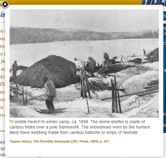
Archaeological excavations at Black City in 1989 and 2004 have identified the remains of cabins outlines, excavated floors of domed skin tents (according to elders, these were seasonal shelters covered with caribou and moose hides), caches and tent sites. Other features in the area included brush and pole trap sets, and a nearby burial fence.
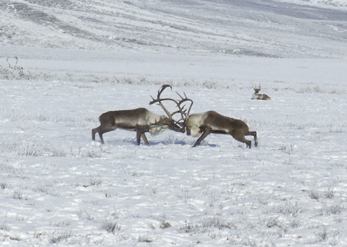
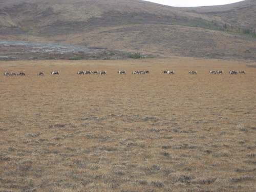
The Porcupine Caribou Herd
The Porcupine Caribou Herd is one of the largest herds of mammals in North America. Currently numbering over 123,000 animals, the herd can appear to observers as a massive moving river of caribou passing over the landscape. Taking no notice of the international border between Canada and the U.S., each year the herd completes an arduous journey from the Yukon into Alaska. The known range of the herd is about 260,000 square kilometres.
The Porcupine Caribou Herd is a barren-ground caribou herd. This means the herd travels to different habitats within their range on a seasonal basis. Even very young calves travel with the herd, crossing open tundra, hills and mountain passes, and swimming swift-flowing rivers and streams. River crossings are particularly treacherous, especially during spring break-up when ice chokes the streams.
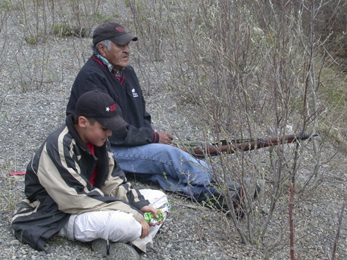
First Hunt
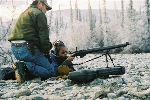
Since the early 1990s, the Tr’ondëk Hwëch’in have introduced community youth to their first hunt under the guidance of experienced hunters and Elders. Every fall, First Nations youth travel up the Dempster Highway to spend time in the country that has always been an important source of food for their ancestors.
Here they camp and learn about the land and the ways of its animal inhabitants, First Nations culture and hunting. Volunteers from the Canadian Rangers teach the youth skills such as map-reading, firearms safety and winter survival. There is also time for fun, with evening games and stories.
Back in Dawson, the youth share the meat with their community at a feast to celebrate the young hunters and the successful hunt. In accordance with custom, Elders receive the remaining meat.
Saving the Caribou
The Porcupine Caribou Herd faces several threats to its survival. Air-borne pollutants from large industrial centres contaminate the lichen which is their main food. Many are concerned about the move to develop oil and gas reserves on the Herd’s calving ground on the coastal plains of Alaska. As well, northern researchers are monitoring the impacts of global warming which influence snow depth, permafrost melt, insect numbers, weather patters and the spread of disease.
The Porcupine herd is hunted by Gwich’in, Hän, Northern Tutchone, Inuvialuit and Inupiat from thirteen communities all of whom have long-standing ties to the herd and are concerned with its survival. The Porcupine Caribou Management Board is an international organization that works to manage the herd and maintain its habitat in Canada.
Joe and Annie Henry
Joe and Annie Henry knew this land intimately. In 1898, Joe was born near the Hart and Wind Rivers while Annie was born in Black City in 1904. After marrying in 1921, they hunted and trapped together on the Blackstone Uplands. Joe and Annie had 13 children, one of whom died in infancy. Their children attended school in Moosehide and Dawson but the family still spent time on this land. Their oldest son Percy became a chief of the Tr’ondëk Hwëch’in and a deacon in the Anglican Church.
Joe Henry guided the cat trains that built winter roads to the Peel plateau in the 1950s and, many years later, the surveyors who marked the route of the year-round road. Annie never stopped working and even in her later years, she was still beading moccasins. They continued to use their trapline cabin at Wolf Creek until their deaths. Joe and Annie left us an invaluable legacy through their work recordings stories of the land and their travels, traditional knowledge and Hän language.
Reverend Richard Martin
Reverend Richard Martin I live at my home at the head of Peel and Porcupine Rivers. My Missionary work — I begin Sunday morning at 11 o'clock, and at 2 o'clock in the afternoon I have school and Bible class, and at 7 in the evening I have service again. Sometimes I go down to Eagle and do all the same there...
RICHARD MARTIN, SYNOD REPORT, CA. 1920
The First Nations church worker most closely associated with the Tr’ondëk Hwëch’in was the Reverend Richard Martin, ordained in 1926. Born at the head of the Peel River, this Gwich’in man was a proficient hunter, trapper, and guide. As a young man, he guided at least one police patrol in the northern Yukon. Martin lost the sight of both eyes in two separate accidents, losing the second eye only a few months after his ordination. After unsuccessful efforts to restore his sight, he settled permanently at Moosehide. Despite his handicap, Reverend Martin played an important role in Anglican Church affairs in the community and the Yukon.
He ministered to the spiritual needs of the Tr’ondëk Hwëch’in during the many intervals between missionaries or when missionaries were away on leave. He interpreted for the ministers who were unable to speak or understand Hän. At Synods for the entire Diocese, he was an inspiration for younger ministers. Many decades after his loss of vision, Martin was able to vividly describe the landmarks of his homeland in the Blackstone River country. Martin remained in Moosehide long after most residents had moved to Dawson, but he finally left the community for good in 1962. When he died in 1975 at the age of 95, the people of Fort McPherson chartered an airplane to attend his funeral.
Read about the life of Reverend Richard Martin here.
Black City Timeline
Gwich’in people stayed at the seasonal settlement of Black City. People then dispersed; many moving to Moosehide, Old Crow and Fort McPherson.
From the height of the Gold Rush period to about 1920, the principal Tukudh and Tetl’it Gwich’in settlement in the area was Black City or Blackstone Village. Some other isolated camps and cabins were located in the Blackstone Uplands, including Calico City, Michelle’s (Old Man Mitchell) cabin, Noil’s (?) cabin, and Alfred Bonnet Plume’s camp.
Takudh Gwich’in and Teetlit Gwich’in people made annual winter trips to Dawson to sell tons of caribou meat that they had hunted on the way. During these visits, they stayed at Moosehide. A number of the Takudh later settled at Moosehide.
Many Gwich’in people died of diseases introduced by stampeders. Reverend Martin tells of digging many graves for people who died of influenza.
The first of the annual police patrols between Dawson City and Fort McPherson, then in later years over the sea ice to Herschel Island. This route was nearly 1000 miles (1600 km) round trip. First Nations guides and hunters were important to the success of these long winter trips.
Fox farming became popular in the Yukon and a number of First Nations people made a good living trapping and selling live foxes. In 1913, the Dawson Daily News reported that Gwich’in people trapped four live foxes and delivered them to Dawson.
10 December, Inspector Frank Fitzgerald led a group of three men on the annual winter patrol between Fort McPherson and Dawson City. For the first time, the patrol travelled from north to south rather than from Dawson to Fort McPherson. Two weeks later, the patrol hired Esau George to guide them across the portage to the Peel River, the last time they were seen alive.
Feb., when the patrol had not reached Dawson by late February, Inspector Dempster was sent out with a search party to find the missing men. They found the bodies of Lost Patrol on March 21 and 22, within a day’s travel of Fort McPherson; then delivered the news to Dawson, traveling 475 miles by dogsled in 19 days.
The failure of Fitzgerald’s patrol was later ascribed to an inexperienced guide, inadequate food and gear for living off the land, and excessive cold, heavy snows and sparse game. As a result of this tragedy, the police-built rest cabins and supply caches along the patrol route and always hired a capable First Nations guide and hunter.
The last resident of Black City moved to Fort McPherson.
February, Cat train crews began building a winter road built from Flat Creek, south of present Dempster Corner, to Eagle Plains and Peel River Plateau.
Construction of highway begins. Oil discovered at Eagle Plains.
The new road was named after Inspector William John Duncan Dempster of the Royal Northwest Mounted Police.
18 August, official opening of the Dempster Highway, Canada’s first all-weather road to cross the Arctic Circle at Flat Creek. Final cost of the highway was nearly $103 million.
Dempster Interpretive Centre opened at Tombstone Campground in a renovated trailer.
Tombstone Park was the subject of Tr’ondëk Hwëch’in Land Claims negotiations.
February 9, 388km² withdrawn from disposal (subsurface withdrawal) for Tombstone Park.
16 July, Tr’ondëk Hwëch’in signed their final and self government agreements.
15 September, land claim & self-government agreements became effective.
Celebration of the 25th Anniversary of completion of the highway. YK and NWT sponsored events in various locales and communities along the length of the highway. Tr’ondëk Hwëch’in citizens celebrated their history on the highway at Black City on August 18th. In October, the Yukon Cabinet officially established Tombstone Territorial Park.