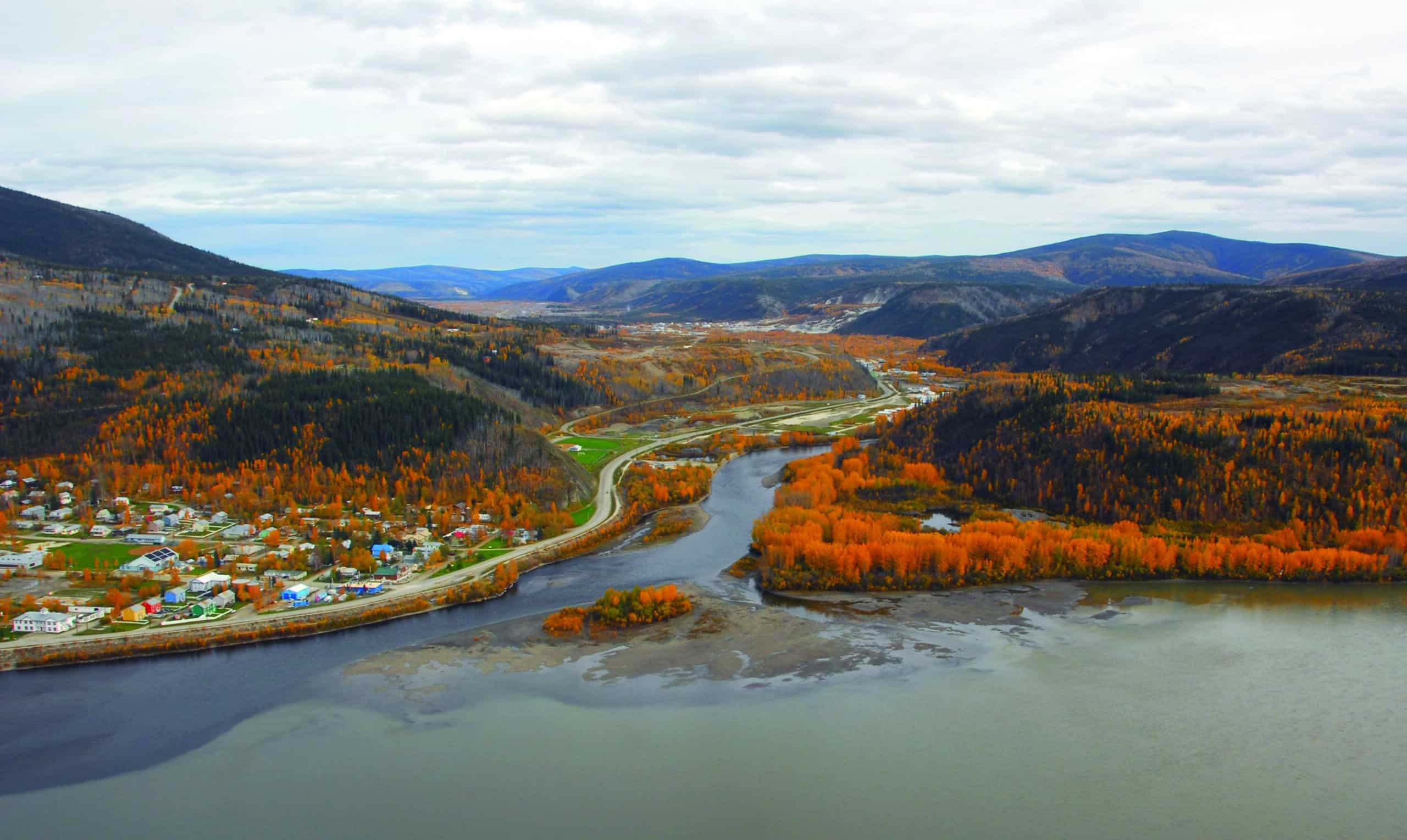
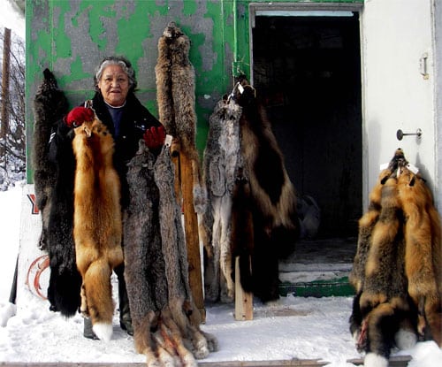
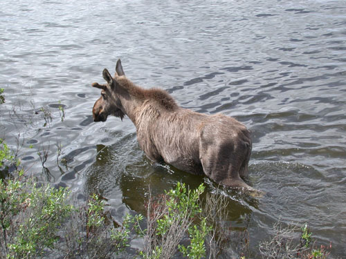
Tr’ochëk – this point of land between the Klondike and Yukon Rivers – is the heart of Tr’ondëk Hwëch’in traditional territory. For hundreds of years, our people came here to fish for salmon, hunt moose up the Klondike Valley, and meet with neighbouring First Nations with whom our ancestors would feast, trade and intermarry.
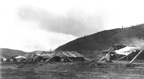
During the Klondike gold rush years, a horde of newcomers displaced our people from Tr’ochëk. This place became known as Lousetown or Klondike City. At different times, Tr’ochëk hosted a bustling fishing camp, a gold rush log cabin settlement, an infamous red-light district, a railway terminus, a sawmill, farming operations, a placer mine and now, once again, a seasonal fish camp.
The importance of Tr’ochëk in our history and culture is formally recognized through the Tr’ondëk Hwëch’in Final Agreement and more recently through its designation as a National Historic Site. Today, we seek to protect Tr’ochëk’s cultural resources and create a peaceful place of natural beauty for relaxation and contemplation where our citizens and others can learn of Tr’ondëk Hwëch’in history and culture.

Setting
Tr’ochëk lies on a low flood plain at the confluence of the Klondike and Yukon Rivers. Over the centuries, the site has been shaped by the erosion and the redeposition of materials as well as by human activity. The site originally had three parts: the low-lying land north of the Klondike River, Klondike Island, and the hill behind the site.
When a sawmill operated on Klondike Island, the channel between the island and Tr’ochëk was dammed to store floating logs. This channel eventually silted in, and the island is now part of the mainland.
The soils of Tr’ochëk are a mixture of clays and river silt that are washed away and redeposited by the regular floods. For many years, this rich soil supported a farm that grew lavish crops during the long summer days.
Parts of the former island have washed away while the sawmill and farm site are now covered in a dense forest.
The site is backed by a steep, rocky bluff now known as Klondike Hill. The hilltop was cleared and levelled during the placer mining in the 1950s. This part of the Yukon was never glaciated and Tr’ochëk lies within the area known as Beringia.
Hydrology
Being at the confluence of two rivers, Tr’ochëk is shaped by the forces of water and ice. Flooding washes away ground and vegetation and redeposits silts, which changes the topography and soils of the site. During spring breakup, huge chunks of ice gouge the banks, reshaping the sides of the river and, during flood, carving new shapes into the landscape as well. At this point in its course, the Yukon River is heavy with silts. Over time, these have created islands and filled in channels, again changing the shape of Tr’ochëk. Upstream mining activity also contributes to the silting.
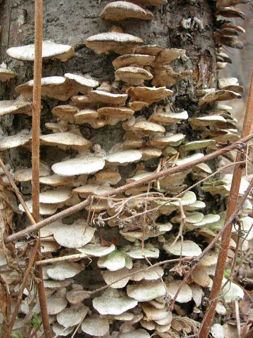
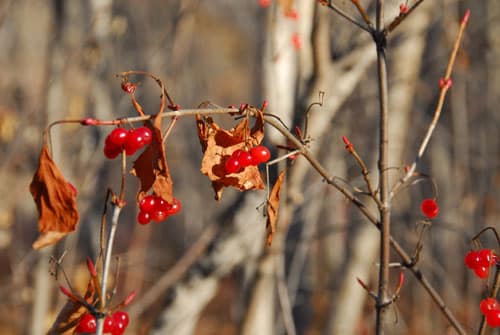
The rivers also create a distinct environment for Tr’ochëk. The low-lying parts of the site are lush with undergrowth and trees that like “wet feet” such as willow, cottonwood, and alder. Dying plants – including sweepers or fallen trees that have been undercut by the current – may shelter juvenile fish or the entrance to an otter’s den. Decaying vegetation supplies food to insects. These are then eaten by bigger creatures, which in turn are the food of larger predators such as salmon, pike, eagles, and bears. Learn more here.
Archaeology
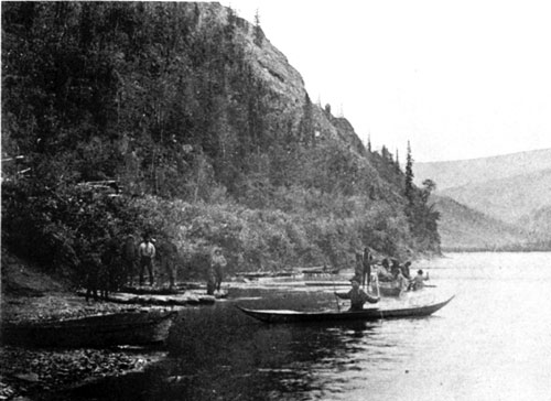
Tr’ochëk has been used as a fishing and hunting camp for many centuries. Unfortunately, periodic floods wiped out most of the remains of these camps. But people returned and made camps on the new silts left by the flood. The floods are clearly represented by grey silt layers in the soil separating dark organic layers that were the ground level between floods. At Tr’ochëk, archaeologists have identified at least six different occupation layers (strata) in the area bordering the Yukon River. Although the crew excavated less than one percent of the site, they found archaeological evidence attesting to the long use of Tr’ochëk as a fishing camp and hide processing site.
Historic Remains
For a relatively brief time in its long history, Tr’ochëk was known as Klondike City or Lousetown. While this settlement lasted less than 20 years, it left a remarkable variety of remains. Unfortunately, none of the buildings still stand. During the peak of the gold rush, the site was thick with miners’ tents and cabins that cascaded down the hillside. The tiny stone platforms that supported these dwellings can still be seen on Klondike Hill. At its peak, the community included a store, brewery, lumber mill, stores, hotels, saloons, and a red-light district. From 1906 on, this was a railway terminus with repair facilities. Once the rush was over, much of the site was cultivated by market gardeners. Due to the thick overgrowth on Tr’ochëk, the few remains are difficult to see and consist mostly of foundation remains and a few pieces of rusting metal.
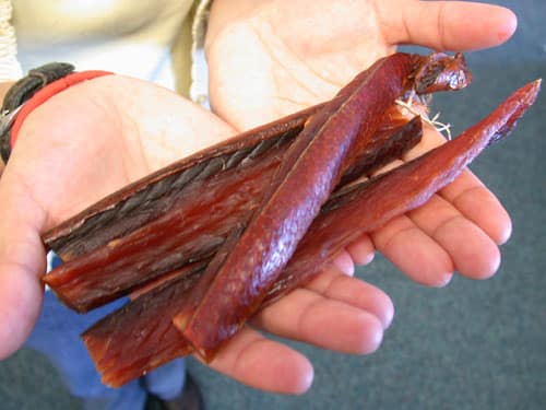
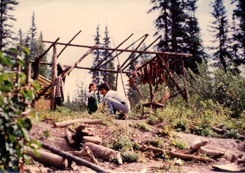
Traditional Fishing Methods
What my old man told me was that the people had fish traps at the mouth of the Klondike River, way before the white people came to this country… When the salmon comes up, the people speared it. They threw them, the salmon, to shore. The women were busy carrying fish and everybody shared.
STANLEY ROBERTS, 1987
In the early days, the Tr’ondëk Hwëch’in built fish traps across the mouth of the Klondike River. Tr’o, the first part of the Hän names, Tr’ondëk and Tr’ochëk, refers to the “hammerstones” used to pound stakes into the riverbed. Branches were woven between the stakes forcing the migrating salmon to travel the length of the weir seeking an opening. The river current then forced the fish sideways at the weir and into one of several basket traps. The baskets had to be emptied regularly or the weight of the salmon could destroy the structure. People removed a load of salmon then allowed the fish to continue their upriver migration for several hours or overnight before resetting the traps.
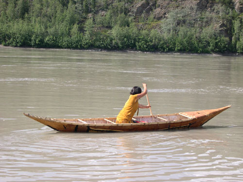
People in canoes also scooped fish out of the river with large dipnets made from caribou babiche woven around a wooden frame. Observers on shore directed the fishers to spots where a riffle in the water indicated the presence of salmon below. The fisher thrust the net into the salmon’s path, twisted the top of the net to secure the catch and either pulled the salmon into the canoe or towed the net to shore. Elder Rowena Flynn told a story of how several people caught salmon at Tr’ochëk using a long net woven from spruce roots.
Changing Fishing Methods
Soon after the gold seekers arrived, traditional birchbark canoes were replaced by pole boats and, from about the 1920s, outboard motorboats.
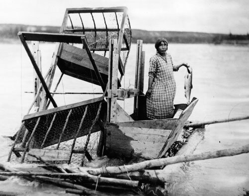
From early in the 20h century, First Nations people began using store-bought nets. The Hän people of the Dawson area also began using the fish wheel, a technology developed on the lower Yukon River about 1904. According to anthropologist Cornelius Osgood, the development of the fish wheel “did for fishing what the power-driven washing machine did for laundering.” River currents turned the wooden wheel set within a frame. Paddles scooped up the fish then, when the fish were raised out of the water, they were funnelled into cruise boxes on either side of the wheel.
The wheel had to be close to the riverbank, otherwise it turned too fast and wouldn’t catch anything. Fishers checked the fish wheel regularly to ensure that sticks or other objects, even an extra-large salmon, didn’t jam its operation.
With modern nets and fish wheels, fishing locations changed from solely at the mouths of creeks and rivers, where we could build traps, to eddies within the main river.
Chief Isaac
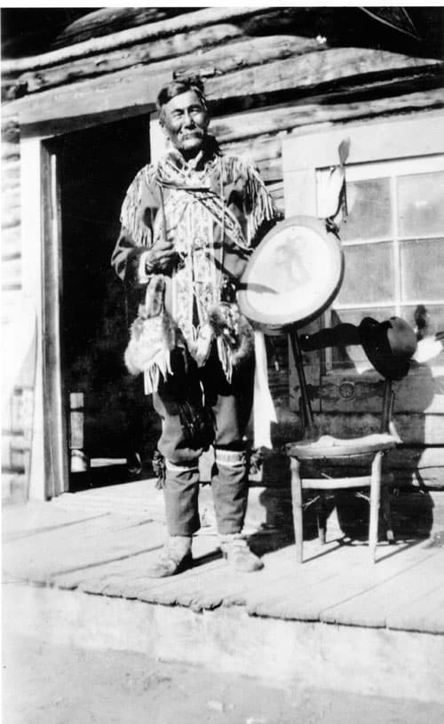
All Yukon belong to my papas. All Klondike belong my people. Long time all mine. Hills all mine, caribou all mine, moose all mine, rabbits all mine, gold all mine. White man come and take all my gold. Take millions, take more hundreds fifty millions, and blow ‘em in Seattle. Now Moosehide Injun want Christmas. Game is gone. White man kills all moose and caribou near Dawson...Moosehides hunt up Klondike, up Sixtymile, up Twentymile, but game is all gone. White man kill all.
CHIEF ISAAC, QUOTED IN DAWSON DAILY NEWS, 16 DECEMBER 1911
The most influential leader of the Tr’ondëk Hwëch’in was Chief Isaac. He led the Hän people from some time before the gold rush until his death in 1932. In many ways, he was a bridge between the old ways and the new. He acted as a go-between between his people and the newcomers, and later between the Tr’ondëk Hwëch’in and the Canadian government. He was skilled in the traditions of his people, but was also very interested in the different ways and technologies introduced by the newcomers. It was with his consent and cooperation that the Tr’ondëk Hwëch’in moved to Moosehide.
To learn more, see the story.
Leaving Tr’ochëk
Within a month of the gold discovery at Bonanza Creek on August 16, 1896, the Hän were forced from Tr’ochëk by the great rush of stampeding miners. Over the next year, mining and other activity destroyed the fish traps and ended salmon fishing at the mouth of the Klondike River. The fish camp of Tr’ochëk was now buried under the tents, cabins and cribs of Lousetown.
At first the Tr’ondëk Hwëch’in moved across the river to Dawson City to the new Mounted Police reserve. The Hän soon realized they needed another base, far from the intrusive newcomers. Over the winter of 1897-98, Chief Isaac, church and government officials agreed that the Tr’ondëk Hwëch’in would move downriver to Moosehide. By spring, people were building cabins and a new community at the site of another of their traditional camps.
Klondike City
Two years after the Hän move from Tr’ochëk, the site had changed beyond recognition. Gone were the fish racks, salmon traps and cooking hearths. Now there was a dense clutter of tents, cabins, caches, a sawmill, brewery, saloon, store, and the one-room cribs of prostitutes. Although, local businessmen called the new community Klondike City, most people knew it best as the infamous red-light district of Lousetown.
The new settlement became the terminus for the Klondike Mines Railway with the tracks running right up the main street and a railway bridge spanning the Klondike River.
Mining Claims & Land Claims
In 1960, the First Nations people of the Yukon were finally given the right to vote in federal elections. In 1973, the Yukon First Nations presented the Canadian governments with the document Together Today for our Children Tomorrow: A Statement of Grievances and an Approach to Settlement by the Yukon Indian People. It was the first comprehensive land claim submitted to the Canadian government by any native group. But it was not until 1992 that Tr’ochëk was recognized as a formal part of the land claim.
In the meantime, the site was almost destroyed.
In the late 1970s, several mining claims were staked at Tr’ochëk. The First Nation and numerous representatives from Yukon heritage groups insisted that a site of such cultural and historic importance should be preserved. Nonetheless, in August 1991, a placer miner leased the claims and began mining the site. When he stopped, approximately 3.3 hectares (8 acres) of Tr’ochëk were ravaged and left covered by two large settling ponds and great heaps of gravel.
Despite a petition to the Canadian government requesting that Canada stop mining activity at Tr’ochëk, no action was taken, and it appeared additional mining was imminent. The heart of Tr’ondëk Hwëch’in traditional territory was threatened with obliteration.
This story does have a happy ending. In May 1997, the First Nation announced that the Canadian government had purchased all mining interests on the site for approximately one million dollars. The ancient village site is to be protected “for all time” as Tr’ondëk Hwëch’in settlement land and a heritage site under the First Nation’s final agreement.
National Historic Site
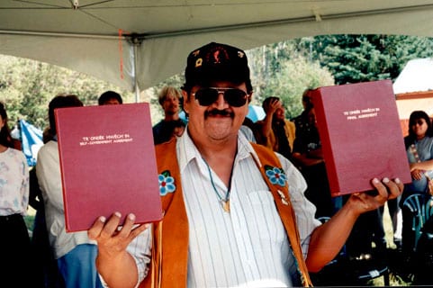
Under the Tr’ondëk Hwëch’in Final Agreement (Chapter 13, Schedule B), Tr’ochëk was designated a First Nation Heritage Site by the Tr’ondëk Hwëch’in with Canada and Yukon as of July 1998. The agreement states that the primary purpose of the site “is to recognize, protect, enhance and celebrate Hän culture and history.”
In November 2001, the Historic Sites and Monuments Board of Canada recommended that Tr’ochëk be designated as a national historic site. It was subsequently designated a National Historic Site of Canada by the Heritage Minister on July 19, 2002.
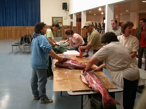
Tr’ochëk Today
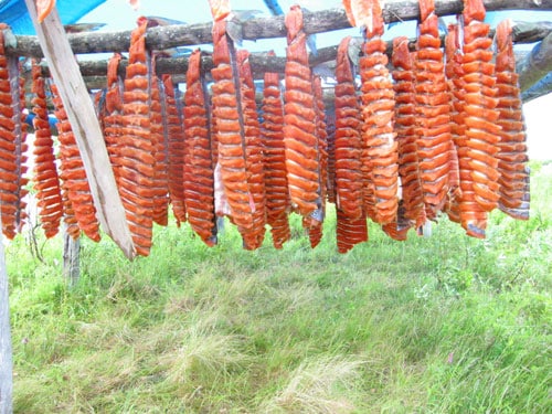
Today Tr’ochëk continues its original function as a seasonal fish camp. Occasionally people harvest berries on the hillside. The Tr’ondëk Hwëch’in Heritage Department has organized culture camps on the site, giving demonstrations of activities such as beaver trapping.
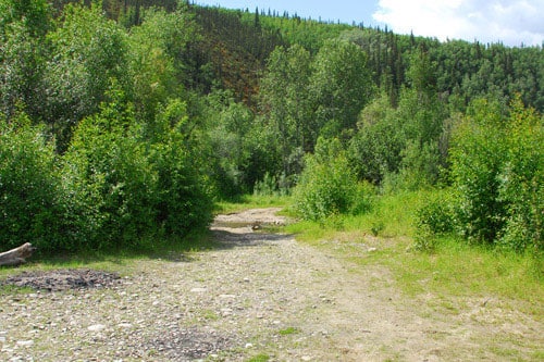
Over the years, a number of mushers travelling to Dawson in winter have staked out their dog teams at Tr’ochëk. There is some recreational use of the site. Dawson residents ski and snowshoe along a rough trail cut on the site in 2007. In summer, the larger dredge pond is used as a swimming hole.
Today, the First Nation seeks to protect the site’s cultural resources and create a peaceful place of natural beauty for relaxation and contemplation where their citizens and others can learn of Tr’ondëk Hwëch’in culture.